Gorgeous New HD Earth at Night Images Brighten Up Your Life
This article is more than 2 years old

The phrase “A picture is worth a thousand words” is sometimes applicable, while other times, a broad overstatement. A sailboat in front of a lighthouse? There’s a novel place to look for inspiration. But pictures from the American Geophysical Union conference demand far, far more. Not that you’re going to get that here.
NASA’s NPOESS Preparatory Project(NPP) is a polar-orbiting environmental satellite used primarily in weather forecasts and observation. The Visible Infrared Imaging Radiometer Suite (VIIRS) on the Suomi NPP satellite has the capability to view the Earth during the night without demolished quality, which is itself an understatement.
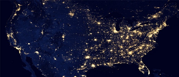
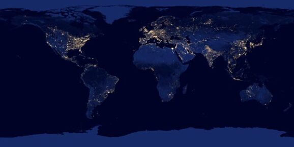
The NOAA and NASA presented to conference attendees these overwhelmingly beautiful pictures, composited from data retrieved during nine days in April 2012 and 13 days in October 2012. It is the first of these image types to show the Earth completely cloudless.
The spread of manmade lighting is as sure a sign of any when trying to locate large cities, measure population density, and by extension, a region’s environmental footprint. The distribution of economic activity can be measured. Carbon dioxide emissions can be measured quantitatively. “The Black Marble,” as it’s being called, is a ball of information in any state it is viewed in, apparently.

I’m fairly certain the right half of the United States is brighter than South America, Africa, and Australia combined. Add in Antarctica and the rest of North America, and the balances weigh out. It’s just amazing to look through the different areas, and it doesn’t do you any good to have me drool about it.
A full assortment of images can be found here, and a zoomable map, which I highly recommend a look at, can be found here.


