Check Out These Recovered Early Satellite Images
This article is more than 2 years old
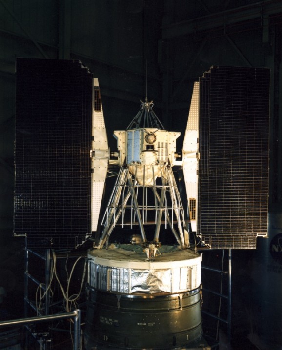
 Satellite images might not seem all that novel these days, but back in 1964, they were groundbreaking. The USSR put Sputnik into space in 1957, which sparked interest in satellites with potential military benefits, as well as to obtain information about good ol’ Earth. In 1964, a satellite called Nimbus 2, a second-generation meteorological research device, orbited Earth until 1966, when its tape recorders stopped working. The only problem was how to store Nimbus’ photos of Earth—this was before the days of scanning and digital archiving. The images it gathered were stored in National Climatic Data Centers in North Carolina and in Washington DC and were largely forgotten. But National Snow & Ice Data Center (NSIDC) scientists David Gallagher and Walt Meier decided they wanted to get their hands on what amounts to billions of dollars worth of data.
The NCDC office told Gallagher he’d have to scan all the images himself—all told, there were 25 boxes of photo rolls. The magnetic film was deteriorating and the labels were unhelpful, and Gallagher knew he’d need the help of the now elderly scientists who helped gather the data, so he got to work. The images weren’t originals—they were actually photos of the original images played back on a television all captured on huge rolls of film.
 A company in Montreal extracted infrared data from the film—and apparently, it was the only one with the right equipment to do so—which amounted to over 200,000 images now contained on a flash drive. Then the researchers had reprocess the data and eliminate errors, which turned out to be an arduous task. Finally, they could begin examining the film to see how it could help him in his work studying sea ice formation and conditions.
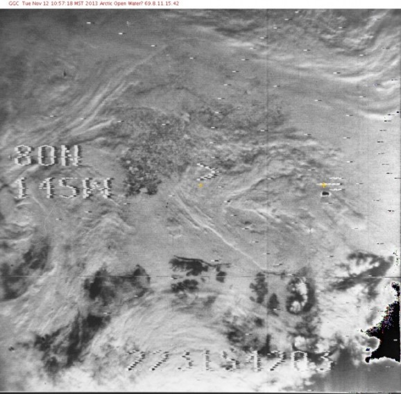
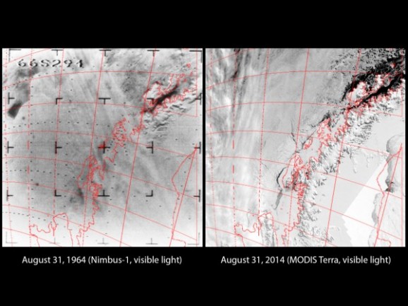 And they weren’t disappointed. They got a look at the Arctic from 1966 in higher resolution than ever previously seen. The photos also included the first image of Europe taken from space, including one of the Aral Sea when it still contained water. The collection also contains pics of sea ice from both the Arctic and Antarctica. Based on the images, the researchers have determined that Antarctica’s sea ice covered nearly 20 million square kilometers in September of 1964, which is a larger amount than depicted in any satellite data between 1972-2012. A photo from 1966 reveals a record low ice pack. The data, which is available for viewing thanks to the NSIDC, will undoubtedly occupy the time and attention of a slew of scientists, particularly for use in the study of climate change, deforestation, and desertification.